
Maps of Banská Štiavnica and the surrounding area
Here you can view digital versions of the paper maps available free of charge at the Tourist Information Centre and from members of the Banská Štiavnica Tourism Association.
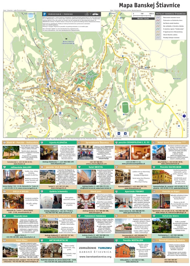
Map of the town centre
This map will help you find your way around the historic centre of Banská Štiavnica and locate the main sights, streets and landmarks. The town centre is hilly and full of winding streets, and many places are best explored on foot.
Please note: Parking information shown directly on the map image may not be up to date. For current recommended car parks, prices and parking rules, please see our Parking in Banská Štiavnica page.
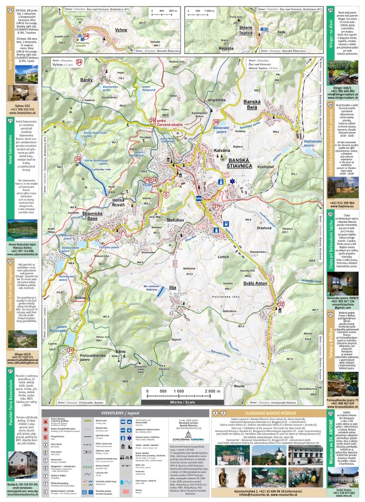
Map of the Banská Štiavnica area
This map is useful for planning trips beyond the historic centre. It shows the tajchy reservoirs, nearby villages, hiking destinations and the wider Štiavnické vrchy area. It is especially useful for planning hikes, trips to the lakes or exploring the surrounding region.
Online maps and navigation
For driving directions, we recommend using up-to-date online maps. For hiking, nature trails and trips in the countryside, dedicated outdoor maps can be especially useful, as they show hiking trails, forest roads, contour lines and terrain in greater detail. We recommend Mapy.com or the mobile app.
Before driving into the town centre, we also recommend checking the latest parking information, as the historic centre has narrow streets and a limited number of parking spaces.